The SRA has now completed detailed modelling work, showing which parts of the catchment area are most likely to be hit by flooding – making it easier to identify and prioritise sites where improvements could be made, reports the Local Democracy Reporting Service.
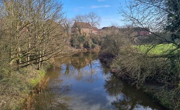
The River Brue begins near Bruton and runs over the Somerset Levels, separating Glastonbury and Street, before reaching the sea next to Burnham-On-Sea Sailing Club where it joins the River Parrett estuary.
Many of the lower reaches of the river are very close to sea level, making the area prone to flooding.
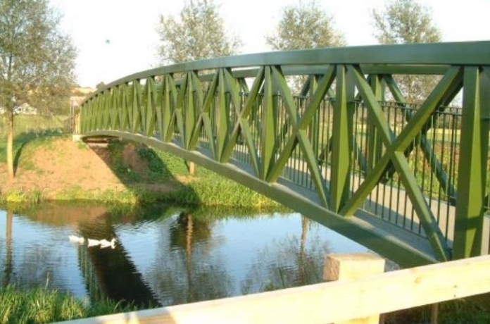
At Highbridge, there is major building work underway along either side of the river – including the Brue Farm housing development, the Walrow industrial estate and the town’s railway station which could soon be connected to Brue Farm by a new bridge, as pictured below in plans.

Highbridge, Burnham-On-Sea and the surrounding villages are protected by the Highbridge Clyce, which prevents saltwater from flooding upstream and bursting the river’s banks during high tides.
But efforts to protect other parts of the catchment have been halted by several factors – including protected species, agricultural practices and the need to protect and improve water quality.
The Axe Brue Internal Drainage Board originally planned to dredge key sections of the river using £279,000 provided to the SRA by the Heart of the South West Local Enterprise Partnership (LEP).
This money was handed back to the SRA in July 2021 after the drainage board was unable to secure a viable dredging scheme which would complement the EA’s existing maintenance programme.
Following this, the SRA was commissioned to carry out new modelling of the Brue catchment area to assess flood risk – work which was formally presented at its most recent board meeting in Bridgwater on January 19.
A number of models have been produced at a cost of £91,170 – including a ‘one in 100 years’ event similar to the 2013/14 floods and a ‘one in two years’ event (estimating more localised flooding).
John Rowlands says in a written report: “The outcome of this work is a model which can be used to provide the scientific justification to support implementation of future schemes in the lowland Brue catchment.”
“This model is now able to be shared with project partners. This model is capable of being used to assess the impacts of any interventions in the area on high flows of water and flood risk. Due to the way the model has been developed to focus on high flows, it is not able to represent low flows, or give information on any of the smaller rhynes, but all of the main rivers are represented along with the moor areas.”
He adds: “It is expected that our partners will now look to use this model in their projects to assess the impacts of any proposals they are considering.”
Modelling can be used to test various projects designed to increase the volume of water which can be carried downstream, or to improve the amount of water which can be safely stored on the moors during heavy rainfall.
The Somerset Wildlife Trust (SWT) had already expressed some interest in improving the river, adds Mr Rowlands, and some payments could be made to farmers to improve the land they own along the river (known as riparian improvements).
Meanwhile, SRA vice-chairman Tony Bradford, who sits on the Parrett Internal Drainage Board, says he wants progress to be made as soon as possible. This could include trimming back trees and vegetation that can block the river.
And he adds: “All the work the SRA has undertaken has been on the Parrett or Tone catchment – nothing’s been done on the Brue. We could see some action immediately – we’ve been kicking this down the road for years. It’s urgent that we go and do this work. If you sit on the Brue stone at Highbridge – the bridge on the A38 Huntspill Road – and look both ways, you struggle to see the water for the trees.”
It is expected that more updates on work to improve the River Brue will be considered by the SRA board in future.


