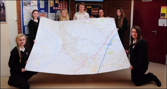
Pupils from King Alfred School are helping to produce a new Neighbourhood Plan for Burnham-On-Sea and Highbridge – and have produced a giant map for their school.
The map shows the Burnham and Highbridge Town Council area and the majority of the Burnham Without parish to the west of the M5 motorway.
The project comes after several Year 7, 8 and sixth form students formed a group to discuss how they’d like to see their home town change in the future.
They have been working to produce a display which was used during a Neighbourhood Planning meeting in December.
Geography Head Catherine Owen told Burnham-On-Sea.com: “It is the start of a fantastic project and resulted in a huge map of area being given to the school, which we can use in our lessons.”
“The map is a really high quality and fascinating resource that has already received a great deal of attention from our students.”
“Phil Harvey from the neighbourhood planning team recently visited the school and has set challenges for our year 7 and 10 geography students related to the plan.”
“I am looking forward to seeing the responses produced and sending the best ones to Mr Harvey.”


