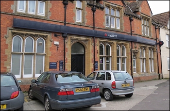
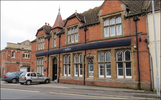
Highbridge’s final bank building won’t be turned into flats after all – following a decision by Sedgemoor District Council this week.
The former Nat West bank building in Huntspill Road closed down in the summer of 2014, as we reported here, and has been vacant ever since.
A planning application for a change of use of the property and the conversion of the ground floor to four flats was considered by the Town Council last month when it was given approval.
However, the final decision always sits with Sedgemoor District Council and, this week, it decided to turn down the scheme.
A Sedgemoor spokesman explained that parking is a key concern behind its judgement.
 “The proposal does not incorporate adequate turning facilities to enable a vehicle to enter and leave the highway in forward gear. Adequate provision cannot be made on the site for the parking of vehicles in a satisfactory manner, which is essential to highway safety. The proposal is therefore contrary to Policies D9 and D10 of the Sedgemoor District Core Strategy and advice contained with the National Planning Policy Framework and Planning Practice Guidance.”
The council also quotes flooding concerns, adding: “The application site is located in Flood Zone 3, an area deemed by the Environment Agency as being at a high risk of flooding and is at risk from both fluvial and tidal sources according to the Environment Agency Flood Map.”
“The River Brue – a main river – runs behind the proposed development. Notwithstanding the mitigation measures proposed, the risk to life and/or property, from tidal inundation would be unacceptable as the site would be within an area which is considered to be at risk to possible deep tidal flooding should the defences be breached or overtopped.”
“This could result in rapid inundation of the site with flood depths in the region of 1 metre.”
“The proposed flats will be located mainly at ground floor level only and would lack a means of escape which means that any occupier does not have a safe place to go in times of a flood.”
 “As a consequence the development increases the risk to life of any potential occupants. The application is therefore contrary to the National Planning Policy Framework and guidance within the Planning Practice Guidance relating to Flood Risk and Coastal Change.”
Highbridge town councillor John Parkes said: “I have previously registered my unhappiness about this scheme – there are parking issues there, and many residents don’t want to see more flats. Some residents tell me it would be better used as a historic facility such as a museum.”
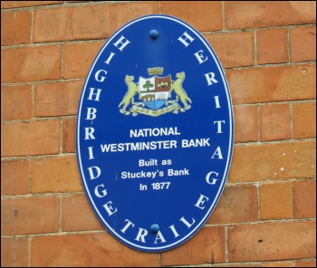
The building was built as Stuckey’s bank in 1877 and a blue heritage trail sign in place on the building, pictured here, recalls its past use.


