Burnham-On-Sea News
October 31, 2004
New study shows Burnham is at risk from sea flooding
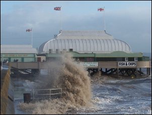
Thousands of homes in Burnham and Highbridge are at risk from flooding, according to a new study from the Environment Agency.
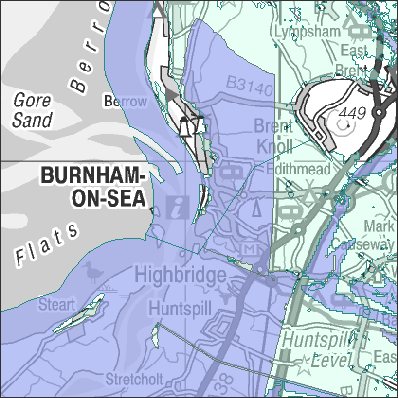
A map released by the agency (pictured right) shows the two towns could be affected in the event of a major breach of the sea wall.
Flood water could even be lapping at the foot of Brent Knoll and go as far inland as Huntspill and Burtle if the sea breached Burnham’s sea wall and the River Brue broke its banks.
Climate change, global warming and predicted sea level rises were all taken into account when drawing up the map, which shows the areas that would be affected in a flood, and also in extreme flood conditions.
Many parts of the two towns have been rated as significant or moderate and have a 1-in-75 chance or greater, of flooding in any year. Parts of Berrow, Brean and Huntspill have also been given this rating. Brent Knoll and East Brent have been rated as low risk but still carry a 1-in-200 chance of flooding.
 A spokesman for the Environment Agency said: “Although this rating takes flood defences in the area into account, they reduce but do not completely remove the likelihood of flooding and can be overtopped or fail in extreme weather conditions.”
According to the Association of British Insurers (ABI), they have been using various versions of the map for years.
An ABI spokesman said: “Insurers have used this flood map for many years and it is just a way of getting more accurate data.”
A spokesman for the Environment Agency added: “To assist householders and insurers in providing insurance, we have supplied ABI member insurance companies with information that gives a national assessment of likelihood of flooding, from rivers and the sea, within the floodplain, taking into account flood defences. It provides the first step for insurers in assessing insurance.”
HAVE YOUR SAY:
Visit Burnham-On-Sea’s Discussion Forum
RELATED LINKS:
Environment Agency
Current Flood Warnings across the UK


