Huge 1607 tsunami and tidal flooding in Bristol Channel left tragedy in Burnham-On-Sea
1607 tsunami hit Burnham-On-Sea and Bristol Channel
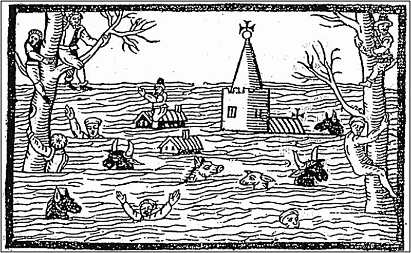
Research into the devastating 1607 flood that affected Burnham-On-Sea and the Bristol Channel in January 1607 has been the subject of a study between Dr Simon Haslett, Head of Geography at Bath Spa University College, author of Coastal Systems and Dr Ted Bryant, School of Geosciences at the University of Wollongong, Australia, and author of Tsunami: the Underrated Hazard.
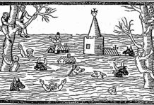
The major flooding occurred around 9am on the 20th January 1606, although in the modern calendar this is the 30th January 1607. The event is recorded on plaques in a number of churches, including those at Kingston Seymour in Somerset, and in Monmouthshire at Goldcliff, St. Brides, Redwick and Peterstone.
Inundation of sea water
The Kingston Seymour plaque reads: “An inundation of the sea water by overflowing and breaking down the Sea banks; happened in this Parish of Kingstone-Seamore, and many others adjoining; by reason whereof many Persons were drown’d and much Cattle and Goods, were lost: the water in the Church was five feet high and the greatest part lay on the ground about ten days. WILLIAM BOWER”
The idea that the 1607 flood was due to a tsunami was first put forward by Haslett and Bryant in a scientific paper published in 2002 in the journal Archaeology in the Severn Estuary.
Huge area affected by 1607 tsunami
A number of historical documents exist that describe the event and its aftermath. An area from Barnstaple in north Devon, up the Bristol Channel and Severn Estuary to Gloucester, then along the South Wales coast around to Cardigan was affected, some 570 km of coastline.
The coastal population was devastated with at least 2,000 fatalities according to one of the contemporary sources.
In some parts of the coast the population never recovered from the social and economic disaster.
Evidence that flood was a tsunami
Haslett and Bryant were led to think that the 1607 flood was caused by a tsunami, rather than a storm, for a number of reasons:
1. Some historical accounts indicate that the weather was fine e.g. “for about nine of the morning, the same being most fayrely and brightly spred, many of the inhabitants of these countreys prepared themselves to their affayres” and the ship at Appldedore (see above) is unlikely to be ready to sail in stormy weather.
2. The sea appears to have been “driven back” i.e. retreated out to sea, before the wave struck, a classic tsunami herald.
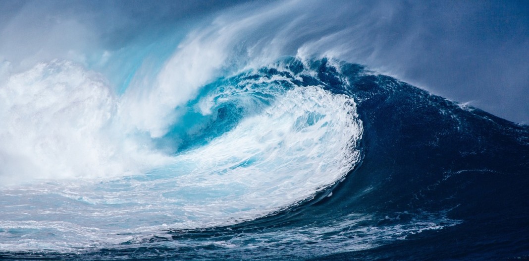
3. The wave appeared as “mighty hilles of water tombling over one another in such sort as if the greatest mountains in the world had overwhelmed the lowe villages or marshy grounds. Sometimes it dazzled many of the spectators that they imagined it had bin some fogge or mist coming with great swiftness towards them and with such a smoke as if mountains were all on fire, and to the view of some it seemed as if myriads of thousands of arrows had been shot forth all at one time.” This is very similar to descriptions of more recent tsunami, such as the tsunami associated with the eruption of Krakatau in 1883, where accounts refer to the sea as being ‘hilly’, and the reference to dazzling, fiery mountains, and myriads of arrows, is reminiscent of accounts of tsunami on the Burin Peninsula (Newfoundland) in 1929, where the wave crest was shining like car headlights, and in Papua New Guinea in 1998 where the wave was frothing and sparkling.
4. The speed of the wave appears to have been faster than a storm flood as the wave is ‘affirmed to have runne with a swiftness so incredible, as that no gray-hounde could have escaped by running before them’.
Surviving evidence of the tsunami
In the summer of 2004, Haslett and Bryant embarked on field work in the area to record any physical impacts of the proposed 1607 tsunami that might still be left in the landscape. They found:
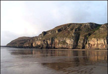
![]() Erosion of rock at the coast that is characteristic of erosion caused by high velocity water flow. This includes two large chunks of farmland on the Severn Estuary north of Bristol that were simply washed away, one where the foundation of the Second Severn Crossing is, and the other is now the reservoir for the Oldbury Nuclear Power Station;
Erosion of rock at the coast that is characteristic of erosion caused by high velocity water flow. This includes two large chunks of farmland on the Severn Estuary north of Bristol that were simply washed away, one where the foundation of the Second Severn Crossing is, and the other is now the reservoir for the Oldbury Nuclear Power Station;
![]() The deposition of layers of sand over wide areas at the time, discovered in boreholes in the ground from north Devon to Gloucestershire to the Gower;
The deposition of layers of sand over wide areas at the time, discovered in boreholes in the ground from north Devon to Gloucestershire to the Gower;
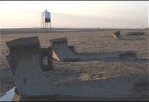
![]() Large boulders that are only easily moved by tsunami waves have been found stacked like dominoes at and above the high tide limits all along the coast.
Large boulders that are only easily moved by tsunami waves have been found stacked like dominoes at and above the high tide limits all along the coast.
These signatures of tsunami enable Haslett and Bryant to estimate the scale of the proposed tsunami wave and its affects.
Height and speed of the 1607 tsunami
Tsunami height – In the open sea area between north Devon and Pembrokeshire, the wave was just under 4m (13ft) high, but as it entered the constricting funnel-shaped Bristol Channel and Severn Estuary, the wave increased in height to 5m (16ft) along the Glamorgan coast, 5.5m (18ft) along the Somerset coast, and over 7.5m (25ft) high, by the time it reached the Monmouthshire coast. This increase in wave height due to the funnel-shape of the estuary is exactly the same as the process that creates the famous Severn Bore.
Tsunami speed – The speed (velocity) of a tsunami is related to its height, so as it moved up estuary and got squeezed between the opposing shores of England and Wales, it got faster, striking the coast at just over 12 m/sec (27mph) in north Devon and southwest Wales, to just under 14 m/sec (31mph) along the Glamorgan coast, to 14.5 m/sec (32mph) in Somerset, and over 17 m/sec (38mph) in Monmouthshire. This agrees well with the contemporary observations regarding the speed of the wave.
Tsunami inundation – On the flat coastal areas the tsunami was able to penetrate a considerable distance inland. The maximum inland penetration possible of a moving tsunami wave in north Devon and southwest Wales would have been just under 2.5 km (1.55 miles), in Glamorgan just over 3 km (1.86 miles), in Somerset just under 4 km (2.5 miles), and in Monmouthshire just under 6 km (3.7 miles). This agrees well with the accounts of the wave reaching up to 4 miles inland at Cardiff and in Monmouthshire. The fact that the floodwaters reached further inland in places, such as to the foot of Glastonbury Tor (14 miles inland) is due to the fact that the landsurface actually slopes landward in many of the coastal wetland areas, such as the Somerset Levels, so once the wave collapsed the water flowed landward under gravity rather than back to the sea.
What caused the tsunami?
A possible cause of the proposed tsunami is not yet known, but the possibilities include a landslide off the continental shelf between Ireland and Cornwall, or an earthquake along an active fault system in the sea south of Ireland. This fault system has apparently experienced an earthquake greater than magnitude 4 on the Richter scale within the last 20 years, so the chance of a bigger tsunami earthquake is a possibility. It may also have been a combination, in that an earthquake might have triggered a submarine slide.
Tsunami’s impact felt in Burnham-On-Sea area
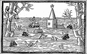
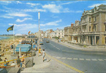
![]() The breaking of the sea bank at Burnham-On-Sea led to some 30 villages being utterly inundated, and their cattle destroyed, and men, women and children besides. The accounts state that 28 people were drowned at Huntspill and 26 at Brean, a death toll that was repeated in many other villages.
The breaking of the sea bank at Burnham-On-Sea led to some 30 villages being utterly inundated, and their cattle destroyed, and men, women and children besides. The accounts state that 28 people were drowned at Huntspill and 26 at Brean, a death toll that was repeated in many other villages.
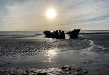
![]() At Appledore, Devon, a 60 tonne ship was well-laden and ready to sail and was driven by the wave onto marshy ground well above high tide, likely never to be recovered.
At Appledore, Devon, a 60 tonne ship was well-laden and ready to sail and was driven by the wave onto marshy ground well above high tide, likely never to be recovered.
![]() In Barnstaple, Devon, the wave burst open doors that were locked and bolted and knocked down many walls and houses, one of which was the house of a James Frost in that the roof and walls collapsed and killed both him and two of his children.
In Barnstaple, Devon, the wave burst open doors that were locked and bolted and knocked down many walls and houses, one of which was the house of a James Frost in that the roof and walls collapsed and killed both him and two of his children.
![]() Near Newport, Gwent, a wealthy women, Mistress Van, lived four miles from the sea and although she saw the wave approaching from her house she could not get upstairs before it rushed through and drowned her.
Near Newport, Gwent, a wealthy women, Mistress Van, lived four miles from the sea and although she saw the wave approaching from her house she could not get upstairs before it rushed through and drowned her.
![]() In Monmouthshire, “a maide child, not passing the age of foure years: it is reported that the mother thereof, perceiving the waters to breake so fast into her house, and not being able to escape with it, and having no clothes on, set it upon a beame in the house, to save it from being drowned. And the waters rushing in a pace, a little chicken as it seemeth, flew up unto it [the child], (it being found in the bosome of it, when helpe came to take it [the child] downe) and by the heate thereof, as it is thought, preserved the childe’s life”.
In Monmouthshire, “a maide child, not passing the age of foure years: it is reported that the mother thereof, perceiving the waters to breake so fast into her house, and not being able to escape with it, and having no clothes on, set it upon a beame in the house, to save it from being drowned. And the waters rushing in a pace, a little chicken as it seemeth, flew up unto it [the child], (it being found in the bosome of it, when helpe came to take it [the child] downe) and by the heate thereof, as it is thought, preserved the childe’s life”.
![]() “Another little childe is affirmed to have been cast uppon land in a cradle, in which was nothing but a catte [cat], the which was discerned as it came floating to the shoare, to leape still from one side of the cradle unto the other, even as if she had been appointed steresman to preserve the small barke from the waves furie”.
“Another little childe is affirmed to have been cast uppon land in a cradle, in which was nothing but a catte [cat], the which was discerned as it came floating to the shoare, to leape still from one side of the cradle unto the other, even as if she had been appointed steresman to preserve the small barke from the waves furie”.
![]() “A certain man and woman having taken a tree for their succour, espying nothing but death before their eyes, at last among other things which were carried along, they perceived a certain tubbe of great bignesse to come nearer and nearer unto them, until it rested upon that tree wherein they were, committed themselves, and were carried safe until they were cast upon the drie shore”.
“A certain man and woman having taken a tree for their succour, espying nothing but death before their eyes, at last among other things which were carried along, they perceived a certain tubbe of great bignesse to come nearer and nearer unto them, until it rested upon that tree wherein they were, committed themselves, and were carried safe until they were cast upon the drie shore”.
![]() “More than did, had perished for want of food, and extreme cold, had not the Rt. Honble. Lord Herbert …. sent out boats to relieve the distresse …. himself goping to such houses as he could minister to their provision of meate and other necessaries”.
“More than did, had perished for want of food, and extreme cold, had not the Rt. Honble. Lord Herbert …. sent out boats to relieve the distresse …. himself goping to such houses as he could minister to their provision of meate and other necessaries”.
This article was adapted from the findings of a Bath Spa University College study issued by Dr Simon Haslett FGS, FRGS.

