Snowfall is covering roads and pavements across the Burnham-On-Sea area this morning (Sunday), with the Met Office’s amber weather warning remaining in force.
Sub-zero temperatures and snow moved in overnight from the east, coating the area in a wintry blanket – see our live seafront webcam. Heavy snow started falling in Burnham at around 10.30pm last night.
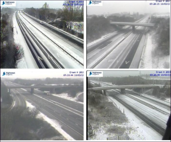
While main roads across the Burnham-On-Sea area have been gritted by Somerset County Council, Police are advising motorists to take extra care in the slippery conditions. The M5 motorway is also only partially open this morning, as pictured below:
The Met Office’s amber warning will remain in place until 9pm this evening.
“A spell of snow is moving west across southwest Britain on Sunday,” said a Met Office spokesman.
“Snow will turn heavy in places on Sunday, and may last for much of the day across parts of southwest England.”
“Strong east or northeasterly winds will lead to some drifting of snow, especially over hills, with significant wind chill.”
“Travel delays on roads are likely, stranding some vehicles and passengers. Delays and cancellations to rail and air travel are likely. Disruption to power supplies is possible.”
Temperatures are forecast to reach no higher than 2C on Sunday but it will feel far cooler in the bitterly easterly winds at around -8C.
Light snow fell during Saturday across the Burnham-On-Sea area. The weather map for early this morning is shown below.
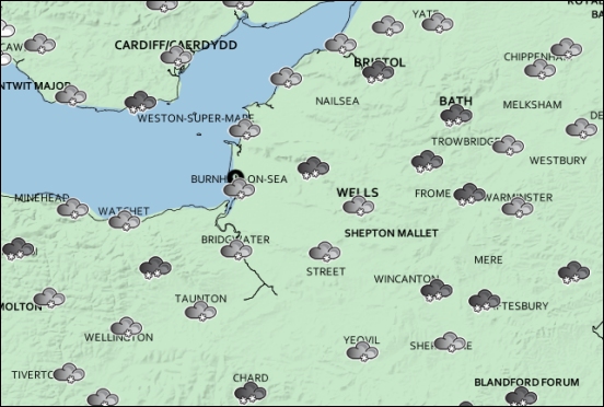
Pictured: The Met Office forecast for this morning across Somerset
Forecasters say the Burnham-On-Sea area is not expected to see the same amount of disruption as experienced at the beginning of March, with less snow expected this time.
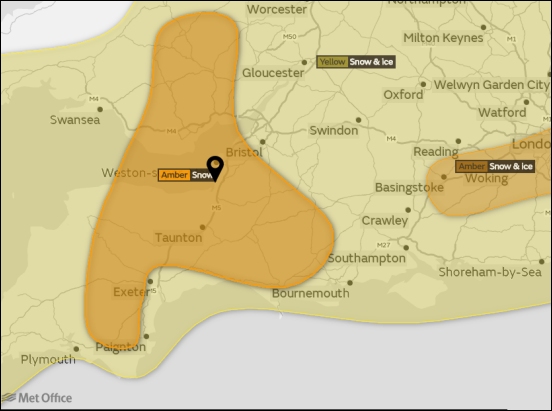
The Met Office’s amber warning stretches from the south coast up into central Wales, with Burnham-On-Sea in the centre of the zone, as pictured.
An amber warning means “there is an increased likelihood of bad weather affecting you, which could potentially disrupt your plans and possibly cause travel delays, road and rail closures, interruption to power and the potential risk to life and property. Be prepared.”
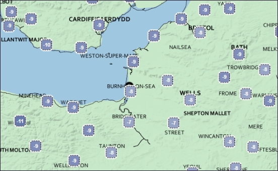
Pictured: The wind chill temperatures early this morning
There is also a separate yellow warning in place for snow and ice covering the whole region, including Burnham-On-Sea. It is defined as: “Severe weather is possible over the next few days and could affect you. Yellow means that you should plan ahead thinking about possible travel delays, or the disruption of your day to day activities. Keep an eye on the latest forecast. Be aware.”
Send us your photos of the snow in the Burnham-On-Sea area